Turns out my friend Bryan Estes has wanted to run this too. Bryan has hiked this section, and various portions of it, numerous times but he has never done it in one push. We had been talking about this since we both ran the Seattle Stairway Foot Tour in June so when his calendar opened up a few days ago, and I was free too, I jumped at the chance. Did it fit in perfectly with my training and racing calendar? No, but when opportunities come along you need to grab them. You also need to keep your racing in perspective - I do this for fun and fun is exactly what I hoped this run would be about. Fun and adventure.
Warning: this blog post contains pictures of bloody knees. :) Nothing too gross hopefully but just so you know.
We did not plan much! Bryan is a very experienced ultra runner, backpacker, and outdoor enthusiast, I could not have picked a better partner. My only decisions were how much of what types of food to carry. Ironically, I made some bad ones in this category. But other good decisions helped me through.
Transportation also was a dream. I was able to drop a car at Snoqualmie Pass Friday evening with Bryan's help and Saturday morning Bryan's in-laws just happened to be driving to Lake Chelan over Stevens Pass and offered to give us a ride. Nice!
At 11:00 AM we were ready to head out from Stevens Pass.
Let me just say that the PCT is amazing! In WA there are so many lakes, views, spectacular trails; we were taking pictures ALL THE TIME.
One of the first treats was running (pun intended) into my sister Lucca. Turns out she was running from the end of Icicle Creek Road to Stevens Pass and we met about 2.5 miles from her finish/our start.
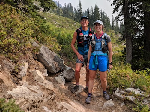
I'm still blown away by how much trail running has helped us reconnect, so grateful for this sport.
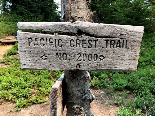
The PCT is really well signed. At about 90% of all the intersections, you see this.
And if there isn't any sign it's obvious which way to go. You just follow the natural flow of the trail and avoid the path that is not "natural" or deviates from the obvious line.
Bryan and I both brought along four 500+ ml containers for water but never needed more than two at a time. There are tons of lakes and streams this time of year and we only got low on water twice but each occurrence was not a crisis and I was able to catch up on my hydration eventually. Something to keep in mind is that we were "running" and a hiker would need more time (and water) to cover the same distance. I put running in quotes as any trail runner knows, running usually includes some hiking. And it can include a LOT of hiking when you go this far.
I seem to have a reputation for falling down while trail running and on this trip I, unfortunately, kept my streak alive. :( The first tumble looked spectacular but once I got myself cleaned up it was no big deal.
Here is the "I just fell down" picture.
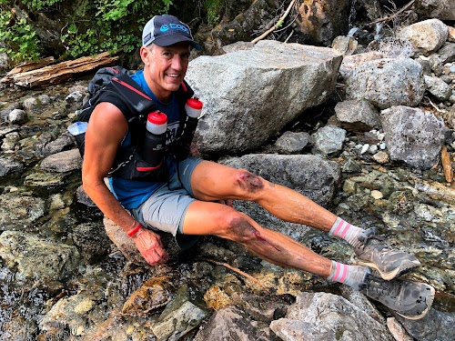
And here is me a few miles after washing my legs in the creek above.

Magic, right?
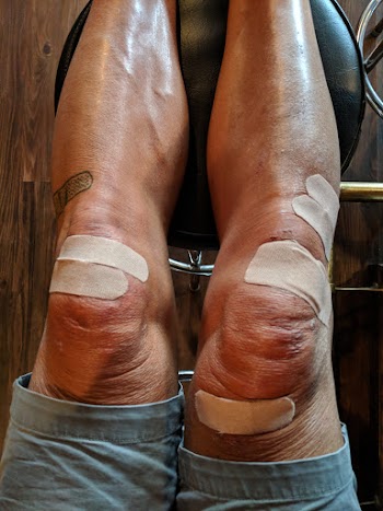
The second fall was a bummer. It happened less than 8 miles from the finish and as usual, it was because I was getting tired and not lifting my feet high enough. This one was a little worse.

Most of the rock around here is granite and when I landed I scraped my right thigh across a wedge of it. But again, looks can be deceiving and after a warm shower, I looked much better.
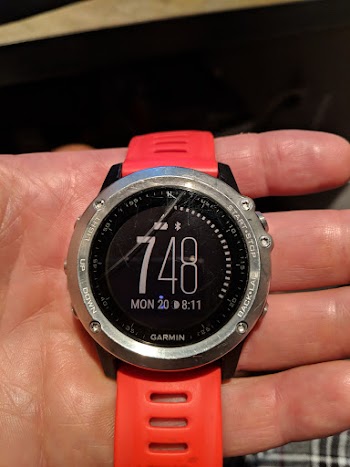
This second fall managed to put a significant gouge in the Gorilla Glass of my watch!
Okay, no more gross stuff, I promise. And rest assured I was super conscious of lifting my feet those last few miles... I think on longer runs I get into this mode of trying to maximize my efficiency and lifting your feet less is more efficient than if you lift them more. Until you trip.
Technology is fun! Of course, you should not rely on it 100% when out in the wilderness but having a GPS tracker along that let me send people progress reports and which let the recipients of these reports reply (great motivation!) was really cool. It was also fun to be able to check our progress on our phones with a mapping app and to have the ability to take all these pictures! Remember giant SLRs? And disposable cameras? Hahaha... We did have a printed map for backup.
I was amazed by all the through-hikers we saw. The PCT is freaking popular! I guess this is the time of year most folks are finishing their north-bound journey. There were also loads of other hikers and backpackers. Don't go here this time of year if you want solitude. :)
I'd like to apologize to those campsites we walked through in the middle of the night with our headlamps on... Normally it would make perfect sense to camp really close to the trail or even right in the trail, right? I mean who's going to show up on a trail at night? One tent was literally in the middle of the trail and it was right at a river crossing so Bryan and I walked around this spot multiple times to be sure we were headed in the correct direction. Finally, the guy in the tent mumbled, "Go down to the water..." I suspect he really meant, "Get the eff out of here NOW!" Sorry guy. Did I mention I love my new headlamp? It's super bright and lasts all night long.
Lately, Seattle has been inundated with smoke from various forest fires and we saw it and felt it on this adventure. Sunday evening it hurt a little to eat and I can still feel my throat Monday but I wouldn't say it's terrible. This trip was so worth it and my throat is already 90% again.
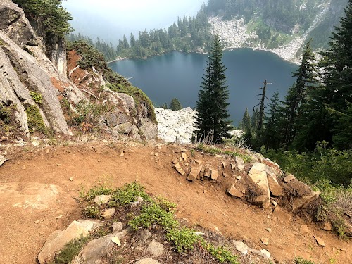
We still had super views but they were not the "I can see for miles and miles" kind. Cases in point.
We didn't have an agenda or time goal but ended up covering ground faster than anticipated. I was hoping to run the last 30 or so miles in daylight as that scenery is some of the most spectacular but we ended up there in the dark and really only had light again for the last 10-12 miles? Rats. But a very contextual rats, this was a freaking awesome trip.
Movies really are the new pictures so here are a few fun snippets of video.
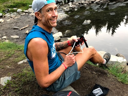
Leaving a lake after filtering water.
Smoke.
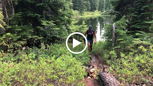
Running along the PCT.
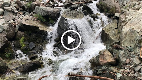
There was plenty of water and various cool "bridges" across it.
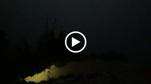
Climbing at night.
The weather was perfect! It never got too hot and we never needed to put anything on at night! Bryan and I spent the entire time in the same outfit. In fact, during the night we commented numerous times how warm it was, the few cool breezes we did get were very much appreciated.
At night all the smoke was unfortunate. I was hoping for an amazing night sky with zero light pollution. Instead we got a blood orange half moon amidst total blackness. Pretty cool, but not what I was hoping for.
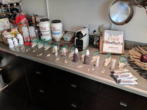
My nutrition was not perfect, Or rather, I need to figure out some alternative fuels for adventures when I'm not racing or when there are no aid stations. I experienced my most dramatic case of "sweet fatigue" and within perhaps 10 miles I was already sick of food bars and within 20 miles the mere thought of a food bar or gel was enough to almost make me throw up. Thank goodness I had brought along alternative fuels! Even so, there were stretches where I was running on fumes more than I wanted to. Hammer Nutrition Perpetuem and Endurolytes Fizz turned out to be lifesavers! The mild flavor of Perpetuem was something I could stomach start to finish and Endurolytes Fizz was always delicious and the electrolytes in them helped drain the water from my gut in a way I have never experienced. There were a few times when we guzzled plain water and each time I felt bloated and like the water was sloshing around in my stomach. That was never the case when I drank water + Endurolytes Fizz. Both of us packed way too many food bars (better safe than sorry I guess) but the number of bars I brought along was laughable. I think it was 20? I ate two and choked down the third. Ditto for the gel. On the upside, we were SO ready to help anyone on the trail that had run out of food... :)
Retelling the entire journey step-by-tedious-step would be just that, boring! I'll try to just provide highlights.
Getting shit ready. And by "shit" I mean nutrition. Everything else (technology, shoes, gear) is pretty much on autopilot these days.
Turns out both Bryan and I like to take pictures, but I think Bryan won that contest on our adventure. Here he is documenting the PCT logo at the trailhead sign at Stevens Pass. I think it was the 10th picture he had taken and we hadn't even started running yet.

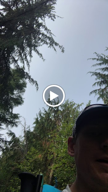
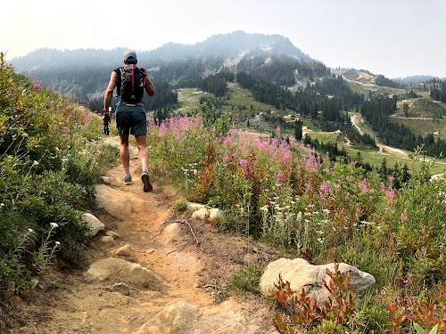
Climbing the very first hill through the Stevens Pass resort. There were wildflowers start to finish!
I hear that equestrians use the PCT a lot. We only saw horses once, it was on this same first climb. The riders were really friendly and the horses were very well behaved.

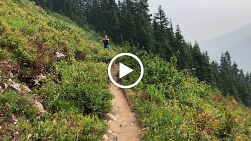
We encountered almost every type of terrain you would expect in the Pacific Northwest. Flowing singletrack, switchbacks, rocky shale (is that redundant?) and water crossings. Sections of this trail were AMAZING, other sections were amazingly resistant to efficient forward motion. :)

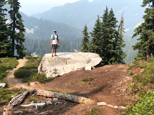
At 54 years old I still like to pose next to big rocks. I also like to jump and touch low hanging signs while walking down the sidewalk, see how far I can make it down a beach while only stepping on driftwood and not on the sand and balancing on parking lot dividers as I walk from my car to the mall/hospital/store. Sue me.

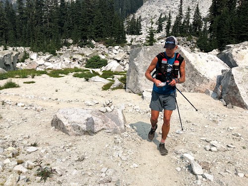
It really was cool to be able to communicate with friends and family while out on the trail. Here I am typing an update into my phone (which was connected to my GPS tracker via Bluetooth) while walking. Barely. I almost tripped a couple of times while doing this but we didn't stop moving! :)

I couldn't get enough of all the water! It helped me clean up, was delicious, and even sounded awesome as you approached it.

We were able to stay dry for all but one water crossing.

The one where we had to get wet was about 20 miles from the finish, right where we woke up that camper in his tent. It was the middle of the night and perhaps there had been an alternative route but we didn't feel like searching. And the water felt REALLY GOOD. In retrospect, I should have stood in it a little longer and cleaned up my legs.
Water from that wet river crossing was the only issue I had the entire trip. My feet stayed wet the rest of the way and 20 miles at our pace was a long time so I had some peeling skin on my heels and the balls of my feet at the finish. But it cleared up within 24 hours so no biggie.
I guess even filtering water can be a blast!
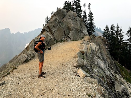
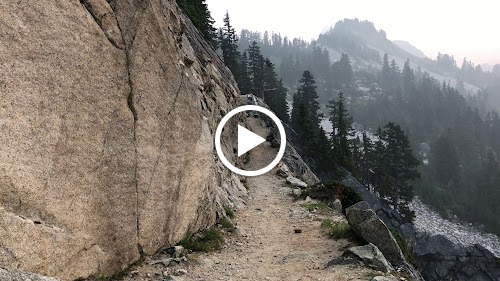
The Kendall Katwalk never fails to impress. Even if it is socked in, just knowing about the exposure and potential views makes it awesome.
Here I am sending another update from the south end of the Kendall Katwalk. This shot captures a lot, some epic scenery, a small person next to big mountains, the smoke, what a day!

Our shoes at the finish.

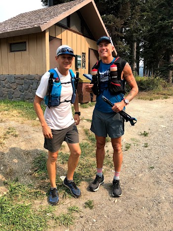
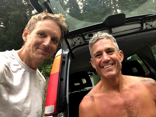
Two happy guys at the finish after spending 21 hours together.
I learned a lot doing this.
- Nutrition - it's not (thank god) just about bars and gels. Next time I plan on packing some things like cheese curd (Lucca gets credit for that suggestion), potatoes with olive oil and salt, smashed up avocados in a ziplock bag, you get the idea. All of these things should keep fairly well.
- Good friends are, well, good. Turns out Bryan and I were very compatible fitness-wise on this adventure and neither of us complained which is a HUGE BONUS. We also love talking about things besides running. That is so refreshing to me.
- Good gear, especially shoes, are so, so, SO important.
- The pack I wore was too big. Sure, it's nice to have the room but even if I had needed all of my clothing (I was carrying a wind shirt, raincoat, undershirt, buff and light gloves) it would have fit in a smaller pack. What I wore had a 22-liter capacity, what Bryan wore had a 15-liter capacity and even he had his pack synched way down to minimize the bounce. That 10-15 liter size seems to be the ticket for most outings.
- My favorite pack has almost everything in the front. That includes TWO bottles, trekking poles, your phone/camera, food, lip balm, etc. The main compartment in the back should really just be for extra clothing or larger items that you won't need very often. I have not found my ideal pack yet but I'm still looking... the Ultimate Direction BP Adventure Vest 3.0 (not the 4.0) comes really darn close. The pack I wore today (because I ripped my Adventure Vest and have not replaced it yet) was comfy on my back but is going straight to eBay. Don't get me wrong, it's freaking well made and freaking technical, it's just not for me and it's too large (in terms of fit, not in terms of capacity necessarily).
When I ran the White River 50 Mile Endurance Run I chose the Topo Athletic Ultrafly 2. Officially this is a road shoe but in my day-to-day training, it's been so darn comfy that I figured why not run an ultra in them? Boom. I have a new favorite ultra shoe. The Terraventure is normally my go-to trail shoe (and it still is), it has a rock plate and lugged sole but if traction will not be a big concern and the course is not especially rocky, the extra cushion of the Ultrafly pretty much compensates and it just protects your body that much more.
Here are all of Bryan's and my pictures. And there are a lot...
Nutrition (before)
- Water
- A smoothie around 7:00 AM
Nutrition (during)
- 8 large bottles each with 1.5 scoops Perpetuem, 2 scoops Endurolytes Extreme Powder, .5 scoops Fully Charged, 1 Race Caps Supreme, 1 Anti-Fatigue Cap, 1 Endurance BCAA+ Cap
- 3 Hammer Bars
- 2 Hammer Gels
- 8(?) large bottles of Endurolytes Fizz (two tablets per bottle)
- 3(?) large bottles of plain water
- 2 Perpetuem Solids
Nutrition (after)
- Large bottle with 3 scoops Recoverite
- 3 Tissue Rejuvenator Caps
- 2 Floyd's of Leadville CBD Softgels
Gear (that I used, I carried a lot more)
- Stance socks
- Topo Athletic Ultrafly 2 shoes
- Patagonia Men's Strider Pro shorts 7"
- Hammer Nutrition Sleeveless Running Shirt
- Topo Athletic Trucker Hat
- Salomon 22-liter pack
- Black Diamond Distance Carbon Z Trekking Poles
- Black Diamond Icon Headlamp (this thing lasted all night on the high power setting no problem)
- Garmin Fenix 3
- Garmin inReach SE
- Mobile phone
- Squirrel's Nut Butter Anti-Chafe Salve
- MSR Water Filter Pump (not the smallest but it has worked for years and it's fast)

Remarkable post. I simply came across your blog and desired to say that I have really enjoyed searching your blog posts. Thank you for sharing such blogs. Section J Consultant Australia
ReplyDelete